
Find the right map for your adventure on the Nickel Plate Trail. Whether you’re planning a ride, looking to print a section map, or exploring regional connections, we’ve got you covered.
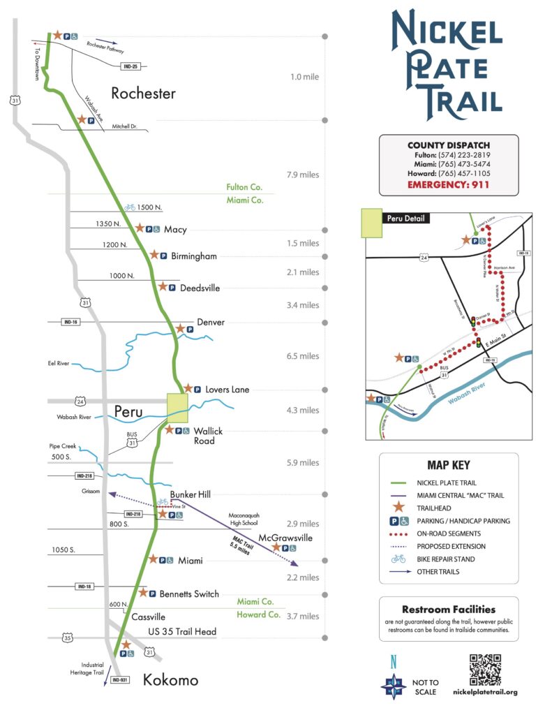
Explore the full 46.9-mile trail with interactive trailheads, parking, restrooms, and landmarks. Updated with the latest access points.
Open Map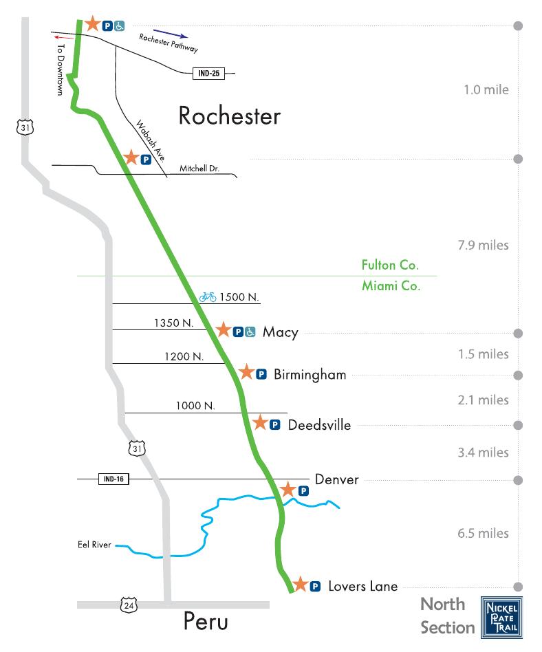
Download or print section-by-section trail maps including the Full Trail, North Section, South Section, and Peru Detail — perfect for your ride.
View Maps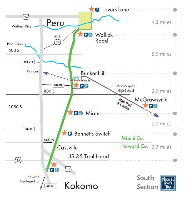
A 28.1-mile route linking the Nickel Plate Trail to the Panhandle Pathway from Peru to Kenneth — great for multi-trail adventures.
Explore Route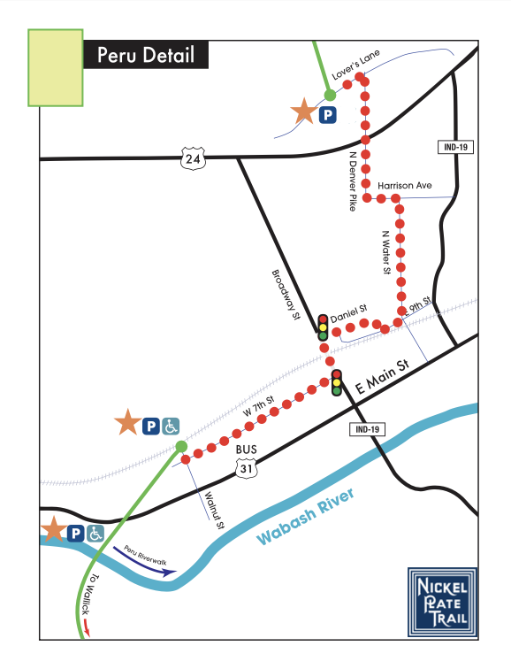
The NPT connects to a growing network of trails across Indiana. Discover other great trails within 75 miles, organized by distance from the NPT.
Explore Trails
The NPT is your gateway to regional and national trail networks. See how local rides connect to Indiana’s broader trail system and beyond.
See Connections