jsonp({"type":"FeatureCollection",
"features":[
{
"type":"Feature",
"geometry":
{
"type":"Point",
"coordinates":[-110.158177,34.902248]
},
"properties":
{
"markerid":"46",
"markername":"Day 7 - October 5",
"basemap":"osm_mapnik",
"lat":"34.902248",
"lon":"-110.158177",
"icon":"motel-2.png",
"iconUrl":"http://www.nickelplatetrail.org/wp-content/uploads/leaflet-maps-marker-icons/motel-2.png",
"address":"Holbrook, AZ, United States",
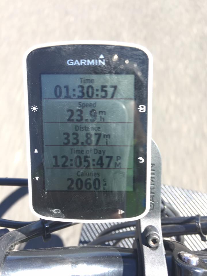
"text":"Rode 100 miles today.
Well over a third of the way to Holbrook, AZ, in just an hour and a half! Beautiful day for riding, legs feel good, wind is at our backs, and there is a nice drop in altitude.
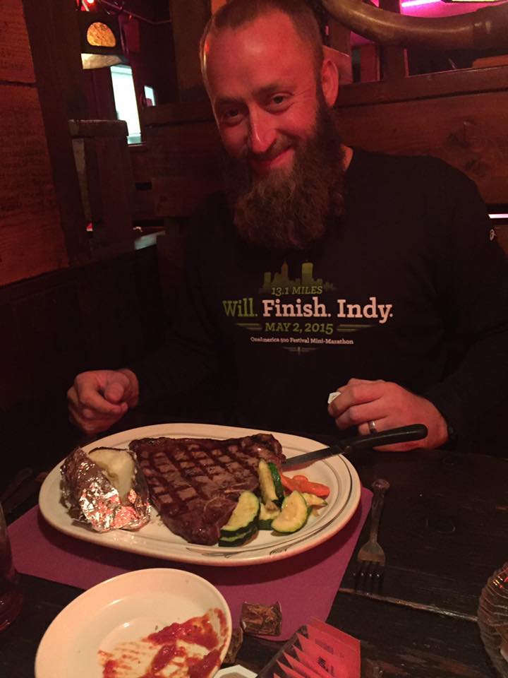
Kicking it up and eating like Kings in Holbrook, AZ this evening. Tomorrow we make our way into New Mexico.
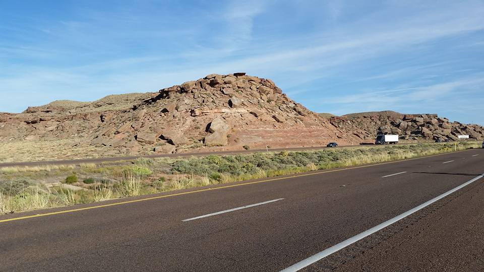
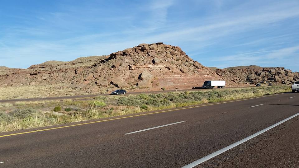
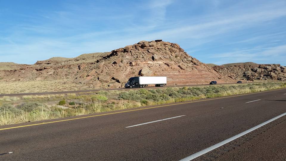
Here are a couple pics from the end of the ride today. I thought it was cool how the rocks were falling apart almost like they were bricks falling out of a wall. I caught the semi going by for perspective.
",
"dlink":"http://maps.google.com/maps?daddr=Holbrook%2C+AZ%2C+United+States&t=m&layer=1&doflg=ptk&om=0",
"zoom":"12",
"openpopup":"0",
"mapwidth":"640",
"mapwidthunit":"px",
"mapheight":"480",
"marker-createdby":"editor",
"marker-createdon":"2016-10-06 08:51:12",
"marker-updatedby":"editor",
"marker-updatedon":"2016-10-06 17:03:26",
"layerid":["12"],
"layername":"Days 1 - 10",
"layer-createdby":"editor",
"layer-createdon":"2016-10-05 21:03:09",
"layer-updatedby":"editor",
"layer-updatedon":"2016-10-10 11:47:40",
"controlbox":"0",
"overlays_custom":"0",
"overlays_custom2":"0",
"overlays_custom3":"0",
"overlays_custom4":"0",
"wms":"0",
"wms2":"0",
"wms3":"0",
"wms4":"0",
"wms5":"0",
"wms6":"0",
"wms7":"0",
"wms8":"0",
"wms9":"0",
"wms10":"0",
"kml_timestamp":"",
"gpx_url":"",
"gpx_panel":"0"
}}]});