jsonp({"type":"FeatureCollection",
"features":[
{
"type":"Feature",
"geometry":
{
"type":"Point",
"coordinates":[-92.334072,38.951705]
},
"properties":
{
"markerid":"72",
"layers":["18"],
"requested_layer":["18"],
"markername":"Day 20 - October 18",
"basemap":"osm_mapnik",
"lat":"38.951705",
"lon":"-92.334072",
"icon":"hotel_0star.png",
"zoom":"11",
"iconUrl":"http://www.nickelplatetrail.org/wp-content/uploads/leaflet-maps-marker-icons/hotel_0star.png",
"address":"Columbia, MO, United States",
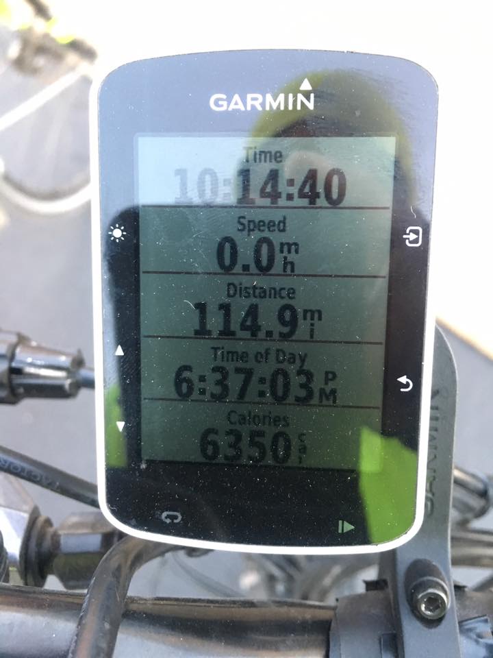
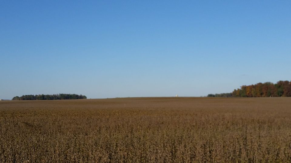
"text":"Rode 120 miles today. Elevation 720
Kind of hard to tell, but we saw a stealth bomber flying around today.

",
"dlink":"http://maps.google.com/maps?daddr=Columbia%2C+MO%2C+United+States&t=m&layer=1&doflg=ptk&om=0",
"openpopup":"0",
"mapwidth":"640",
"mapwidthunit":"px",
"mapheight":"480",
"marker-createdby":"editor",
"marker-createdon":"2016-10-19 09:21:09",
"marker-updatedby":"editor",
"marker-updatedon":"2016-10-19 09:36:58",
"layerid":["18"],
"layername":"Day 20 - 28",
"layer-createdby":"editor",
"layer-createdon":"2016-10-19 09:36:40",
"layer-updatedby":"editor",
"layer-updatedon":"2016-10-29 09:51:15",
"controlbox":"0",
"overlays_custom":"0",
"overlays_custom2":"0",
"overlays_custom3":"0",
"overlays_custom4":"0",
"wms":"0",
"wms2":"0",
"wms3":"0",
"wms4":"0",
"wms5":"0",
"wms6":"0",
"wms7":"0",
"wms8":"0",
"wms9":"0",
"wms10":"0",
"kml_timestamp":"",
"gpx_url":"",
"gpx_panel":"0",
"mlm_filter":"1",
"mlm_filter_details":""
}},
{
"type":"Feature",
"geometry":
{
"type":"Point",
"coordinates":[-90.805129,39.607825]
},
"properties":
{
"markerid":"73",
"layers":["18"],
"requested_layer":["18"],
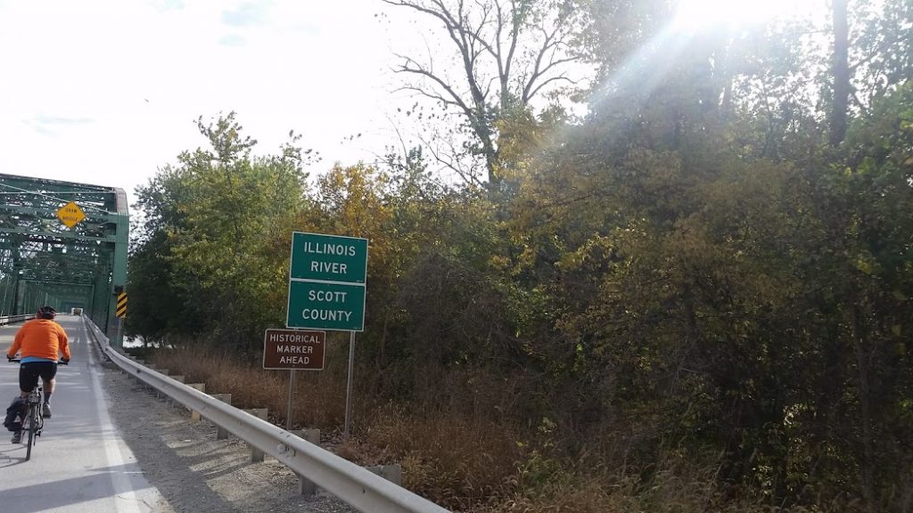
"markername":"Day 21 - October 19",
"basemap":"osm_mapnik",
"lat":"39.607825",
"lon":"-90.805129",
"icon":"hotel_0star.png",
"zoom":"11",
"iconUrl":"http://www.nickelplatetrail.org/wp-content/uploads/leaflet-maps-marker-icons/hotel_0star.png",
"address":"Pittsfield, IL, United States",
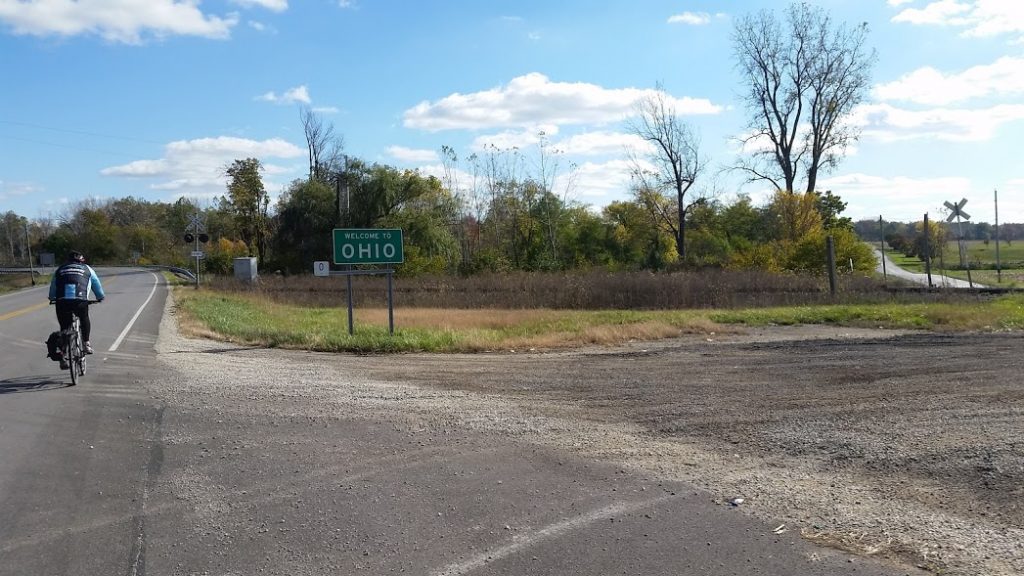
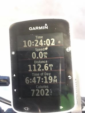
"text":"Rode 115 miles today.
Big crossing ahead!
Annnd boom goes the dynamite. Another state down!
",
"dlink":"http://maps.google.com/maps?daddr=Pittsfield%2C+IL%2C+United+States&t=m&layer=1&doflg=ptk&om=0",
"openpopup":"0",
"mapwidth":"640",
"mapwidthunit":"px",
"mapheight":"480",
"marker-createdby":"editor",
"marker-createdon":"2016-10-20 10:42:29",
"marker-updatedby":"editor",
"marker-updatedon":"2016-10-20 10:42:29",
"layerid":["18"],
"layername":"Day 20 - 28",
"layer-createdby":"editor",
"layer-createdon":"2016-10-19 09:36:40",
"layer-updatedby":"editor",
"layer-updatedon":"2016-10-29 09:51:15",
"controlbox":"0",
"overlays_custom":"0",
"overlays_custom2":"0",
"overlays_custom3":"0",
"overlays_custom4":"0",
"wms":"0",
"wms2":"0",
"wms3":"0",
"wms4":"0",
"wms5":"0",
"wms6":"0",
"wms7":"0",
"wms8":"0",
"wms9":"0",
"wms10":"0",
"kml_timestamp":"",
"gpx_url":"",
"gpx_panel":"0",
"mlm_filter":"1",
"mlm_filter_details":""
}},
{
"type":"Feature",
"geometry":
{
"type":"Point",
"coordinates":[-88.954800,39.840315]
},
"properties":
{
"markerid":"74",
"layers":["18"],
"requested_layer":["18"],
"markername":"Day 22 - October 21",
"basemap":"osm_mapnik",
"lat":"39.840315",
"lon":"-88.954800",
"icon":"hotel_0star.png",
"zoom":"13",
"iconUrl":"http://www.nickelplatetrail.org/wp-content/uploads/leaflet-maps-marker-icons/hotel_0star.png",
"address":"Decatur, IL, United States",
"text":"Rode 115 miles today. Elevation 799.
",
"dlink":"http://maps.google.com/maps?daddr=Decatur%2C+IL%2C+United+States&t=m&layer=1&doflg=ptk&om=0",
"openpopup":"0",
"mapwidth":"640",
"mapwidthunit":"px",
"mapheight":"480",
"marker-createdby":"editor",
"marker-createdon":"2016-10-21 11:37:25",
"marker-updatedby":"editor",
"marker-updatedon":"2016-10-21 11:50:26",
"layerid":["18"],
"layername":"Day 20 - 28",
"layer-createdby":"editor",
"layer-createdon":"2016-10-19 09:36:40",
"layer-updatedby":"editor",
"layer-updatedon":"2016-10-29 09:51:15",
"controlbox":"0",
"overlays_custom":"0",
"overlays_custom2":"0",
"overlays_custom3":"0",
"overlays_custom4":"0",
"wms":"0",
"wms2":"0",
"wms3":"0",
"wms4":"0",
"wms5":"0",
"wms6":"0",
"wms7":"0",
"wms8":"0",
"wms9":"0",
"wms10":"0",
"kml_timestamp":"",
"gpx_url":"",
"gpx_panel":"0",
"mlm_filter":"1",
"mlm_filter_details":""
}},
{
"type":"Feature",
"geometry":
{
"type":"Point",
"coordinates":[-87.228966,40.284763]
},
"properties":
{
"markerid":"75",
"layers":["18"],
"requested_layer":["18"],
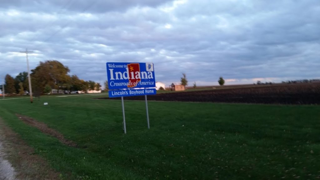
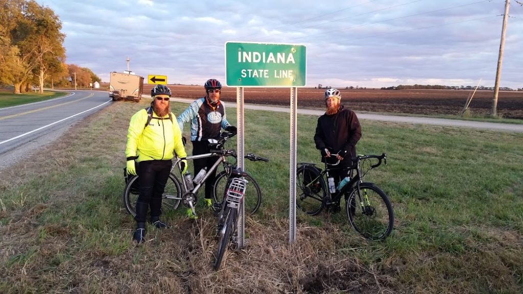
"markername":"Day 23 - October 21",
"basemap":"osm_mapnik",
"lat":"40.284763",
"lon":"-87.228966",
"icon":"motel-2.png",
"zoom":"5",
"iconUrl":"http://www.nickelplatetrail.org/wp-content/uploads/leaflet-maps-marker-icons/motel-2.png",
"address":"Attica Inn, North Long Avenue, Attica, IN, United States",
"text":"Rode 115 miles today. Elevation 455.
",
"dlink":"http://maps.google.com/maps?daddr=Attica+Inn%2C+North+Long+Avenue%2C+Attica%2C+IN%2C+United+States&t=m&layer=1&doflg=ptk&om=0",
"openpopup":"0",
"mapwidth":"640",
"mapwidthunit":"px",
"mapheight":"480",
"marker-createdby":"editor",
"marker-createdon":"2016-10-22 10:10:18",
"marker-updatedby":"editor",
"marker-updatedon":"2016-10-22 10:10:18",
"layerid":["18"],
"layername":"Day 20 - 28",
"layer-createdby":"editor",
"layer-createdon":"2016-10-19 09:36:40",
"layer-updatedby":"editor",
"layer-updatedon":"2016-10-29 09:51:15",
"controlbox":"0",
"overlays_custom":"0",
"overlays_custom2":"0",
"overlays_custom3":"0",
"overlays_custom4":"0",
"wms":"0",
"wms2":"0",
"wms3":"0",
"wms4":"0",
"wms5":"0",
"wms6":"0",
"wms7":"0",
"wms8":"0",
"wms9":"0",
"wms10":"0",
"kml_timestamp":"",
"gpx_url":"",
"gpx_panel":"0",
"mlm_filter":"1",
"mlm_filter_details":""
}},
{
"type":"Feature",
"geometry":
{
"type":"Point",
"coordinates":[-86.133603,40.486427]
},
"properties":
{
"markerid":"76",
"layers":["18"],
"requested_layer":["18"],
"markername":"Day 24 - October 22",
"basemap":"osm_mapnik",
"lat":"40.486427",
"lon":"-86.133603",
"icon":"home.png",
"zoom":"11",
"iconUrl":"http://www.nickelplatetrail.org/wp-content/uploads/leaflet-maps-marker-icons/home.png",
"address":"Kokomo, IN, United States",
"text":"Look who's getting ready to meet the riders!
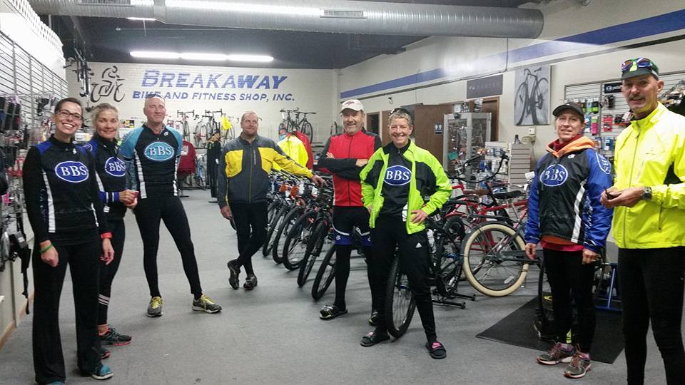
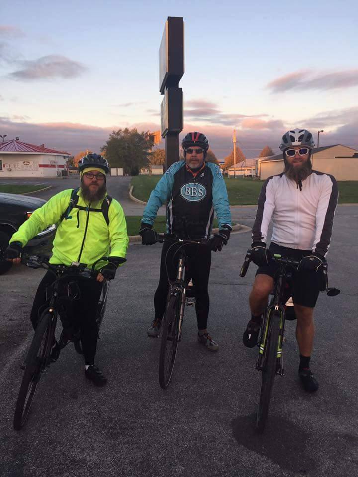
What a FANTASTIC day! Day 24 (Saturday) - 70 miles, our BBS Team rode 47 miles, the weather was great, (bonus tailwind ), positive vibes, nice lunch. So good for Zac, Jeff, and Joey to see familiar faces! Trip will resume on Monday

",
"dlink":"http://maps.google.com/maps?daddr=Kokomo%2C+IN%2C+United+States&t=m&layer=1&doflg=ptk&om=0",
"openpopup":"0",
"mapwidth":"640",
"mapwidthunit":"px",
"mapheight":"480",
"marker-createdby":"editor",
"marker-createdon":"2016-10-22 10:25:34",
"marker-updatedby":"editor",
"marker-updatedon":"2016-10-23 17:49:45",
"layerid":["18"],
"layername":"Day 20 - 28",
"layer-createdby":"editor",
"layer-createdon":"2016-10-19 09:36:40",
"layer-updatedby":"editor",
"layer-updatedon":"2016-10-29 09:51:15",
"controlbox":"0",
"overlays_custom":"0",
"overlays_custom2":"0",
"overlays_custom3":"0",
"overlays_custom4":"0",
"wms":"0",
"wms2":"0",
"wms3":"0",
"wms4":"0",
"wms5":"0",
"wms6":"0",
"wms7":"0",
"wms8":"0",
"wms9":"0",
"wms10":"0",
"kml_timestamp":"",
"gpx_url":"",
"gpx_panel":"0",
"mlm_filter":"1",
"mlm_filter_details":""
}},
{
"type":"Feature",
"geometry":
{
"type":"Point",
"coordinates":[-84.186028,40.267407]
},
"properties":
{
"markerid":"77",
"layers":["18"],
"requested_layer":["18"],
"markername":"Day 25 - October 24",
"basemap":"osm_mapnik",
"lat":"40.267407",
"lon":"-84.186028",
"icon":"hotel_0star.png",
"zoom":"11",
"iconUrl":"http://www.nickelplatetrail.org/wp-content/uploads/leaflet-maps-marker-icons/hotel_0star.png",
"address":"Hampton Inn Sidney, Hampton Court, Sidney, OH, United States",
"text":"Rode 115 miles today. Good Weather.
As they begin the final days of this incredible journey, we can't thank you enough for all your support and encouragement! They left Kokomo early Monday morning headed for Ohio.
",
"dlink":"http://maps.google.com/maps?daddr=Hampton+Inn+Sidney%2C+Hampton+Court%2C+Sidney%2C+OH%2C+United+States&t=m&layer=1&doflg=ptk&om=0",
"openpopup":"0",
"mapwidth":"640",
"mapwidthunit":"px",
"mapheight":"480",
"marker-createdby":"editor",
"marker-createdon":"2016-10-25 09:29:49",
"marker-updatedby":"editor",
"marker-updatedon":"2016-10-25 09:55:37",
"layerid":["18"],
"layername":"Day 20 - 28",
"layer-createdby":"editor",
"layer-createdon":"2016-10-19 09:36:40",
"layer-updatedby":"editor",
"layer-updatedon":"2016-10-29 09:51:15",
"controlbox":"0",
"overlays_custom":"0",
"overlays_custom2":"0",
"overlays_custom3":"0",
"overlays_custom4":"0",
"wms":"0",
"wms2":"0",
"wms3":"0",
"wms4":"0",
"wms5":"0",
"wms6":"0",
"wms7":"0",
"wms8":"0",
"wms9":"0",
"wms10":"0",
"kml_timestamp":"",
"gpx_url":"",
"gpx_panel":"0",
"mlm_filter":"1",
"mlm_filter_details":""
}},
{
"type":"Feature",
"geometry":
{
"type":"Point",
"coordinates":[-82.401207,40.060111]
},
"properties":
{
"markerid":"83",
"layers":["18"],
"requested_layer":["18"],
"markername":"Day 26 - October 25",
"basemap":"osm_mapnik",
"lat":"40.060111",
"lon":"-82.401207",
"icon":"hotel_0star.png",
"zoom":"11",
"iconUrl":"http://www.nickelplatetrail.org/wp-content/uploads/leaflet-maps-marker-icons/hotel_0star.png",
"address":"DoubleTree by Hilton Newark Ohio, North 2nd Street, Newark, OH, United States",
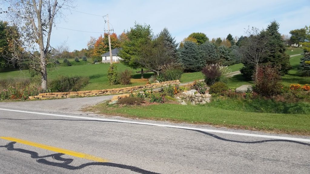
"text":"Rode 113 miles. Elevation 460.
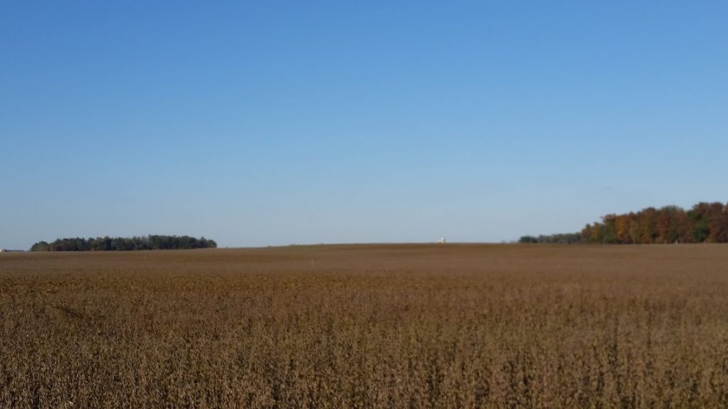
Saw a silo in the beans. In a week or so it will be the other way around.
",
"dlink":"http://maps.google.com/maps?daddr=DoubleTree+by+Hilton+Newark+Ohio%2C+North+2nd+Street%2C+Newark%2C+OH%2C+United+States&t=m&layer=1&doflg=ptk&om=0",
"openpopup":"0",
"mapwidth":"640",
"mapwidthunit":"px",
"mapheight":"480",
"marker-createdby":"editor",
"marker-createdon":"2016-10-26 19:51:15",
"marker-updatedby":"editor",
"marker-updatedon":"2016-10-26 19:51:15",
"layerid":["18"],
"layername":"Day 20 - 28",
"layer-createdby":"editor",
"layer-createdon":"2016-10-19 09:36:40",
"layer-updatedby":"editor",
"layer-updatedon":"2016-10-29 09:51:15",
"controlbox":"0",
"overlays_custom":"0",
"overlays_custom2":"0",
"overlays_custom3":"0",
"overlays_custom4":"0",
"wms":"0",
"wms2":"0",
"wms3":"0",
"wms4":"0",
"wms5":"0",
"wms6":"0",
"wms7":"0",
"wms8":"0",
"wms9":"0",
"wms10":"0",
"kml_timestamp":"",
"gpx_url":"",
"gpx_panel":"0",
"mlm_filter":"1",
"mlm_filter_details":""
}},
{
"type":"Feature",
"geometry":
{
"type":"Point",
"coordinates":[-80.864788,40.074496]
},
"properties":
{
"markerid":"84",
"layers":["18"],
"requested_layer":["18"],
"markername":"Day 27 - October 26",
"basemap":"osm_mapnik",
"lat":"40.074496",
"lon":"-80.864788",
"icon":"hotel_0star.png",
"zoom":"11",
"iconUrl":"http://www.nickelplatetrail.org/wp-content/uploads/leaflet-maps-marker-icons/hotel_0star.png",
"address":"Hampton Inn Wheeling\/St. Clairsville, National Road East, Saint Clairsville, OH, United States",
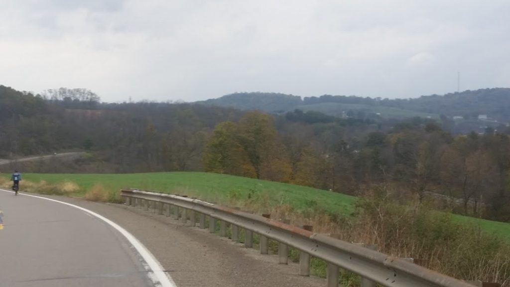
"text":"Rode 115 miles. Elevation 1100.
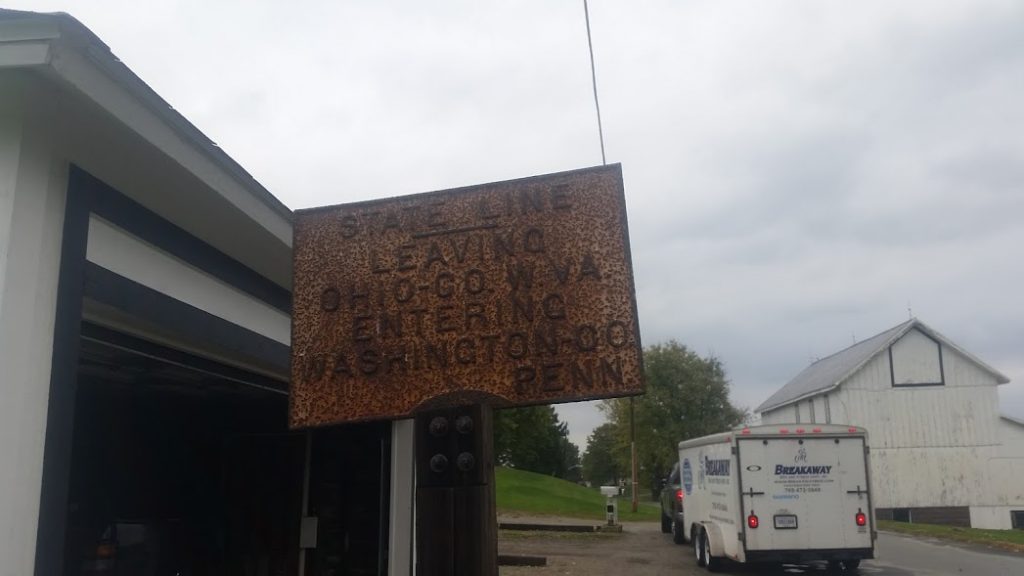
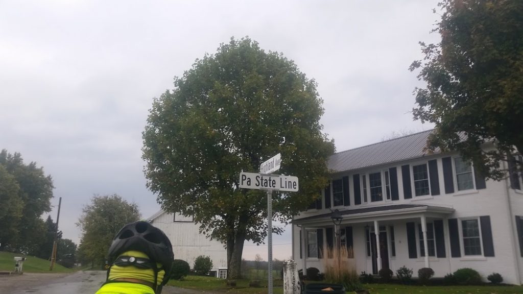
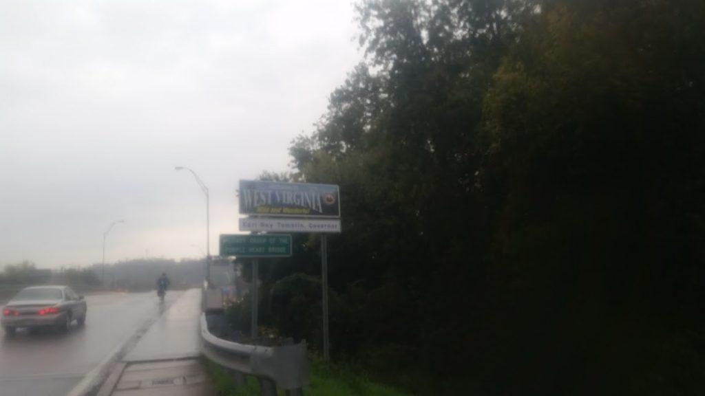
Bedding down near the West Virginia border this evening. Good ride today with plenty of hills, pretty chilly, and some rain. We are just over 400 miles away from the Big Apple! Tomorrow we will be rolling through WV and into Pennsylvania.
",
"dlink":"http://maps.google.com/maps?daddr=Hampton+Inn+Wheeling%2FSt.+Clairsville%2C+National+Road+East%2C+Saint+Clairsville%2C+OH%2C+United+States&t=m&layer=1&doflg=ptk&om=0",
"openpopup":"0",
"mapwidth":"640",
"mapwidthunit":"px",
"mapheight":"480",
"marker-createdby":"editor",
"marker-createdon":"2016-10-26 20:00:28",
"marker-updatedby":"editor",
"marker-updatedon":"2016-10-26 20:36:16",
"layerid":["18"],
"layername":"Day 20 - 28",
"layer-createdby":"editor",
"layer-createdon":"2016-10-19 09:36:40",
"layer-updatedby":"editor",
"layer-updatedon":"2016-10-29 09:51:15",
"controlbox":"0",
"overlays_custom":"0",
"overlays_custom2":"0",
"overlays_custom3":"0",
"overlays_custom4":"0",
"wms":"0",
"wms2":"0",
"wms3":"0",
"wms4":"0",
"wms5":"0",
"wms6":"0",
"wms7":"0",
"wms8":"0",
"wms9":"0",
"wms10":"0",
"kml_timestamp":"",
"gpx_url":"",
"gpx_panel":"0",
"mlm_filter":"1",
"mlm_filter_details":""
}},
{
"type":"Feature",
"geometry":
{
"type":"Point",
"coordinates":[-79.701155,40.324514]
},
"properties":
{
"markerid":"85",
"layers":["18"],
"requested_layer":["18"],
"markername":"Day 28 - October 27",
"basemap":"osm_mapnik",
"lat":"40.324514",
"lon":"-79.701155",
"icon":"hotel_0star.png",
"zoom":"14",
"iconUrl":"http://www.nickelplatetrail.org/wp-content/uploads/leaflet-maps-marker-icons/hotel_0star.png",
"address":"Irwin, PA, United States",
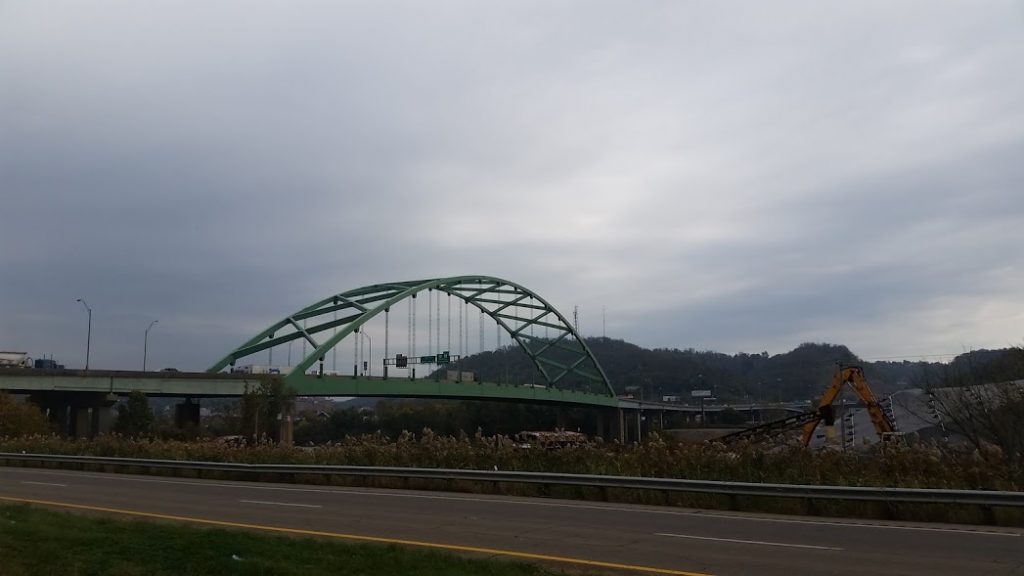
"text":"113 miles today.
",
"dlink":"http://maps.google.com/maps?daddr=Irwin%2C+PA%2C+United+States&t=m&layer=1&doflg=ptk&om=0",
"openpopup":"0",
"mapwidth":"640",
"mapwidthunit":"px",
"mapheight":"480",
"marker-createdby":"editor",
"marker-createdon":"2016-10-28 10:00:56",
"marker-updatedby":"editor",
"marker-updatedon":"2016-10-29 09:51:23",
"layerid":["18"],
"layername":"Day 20 - 28",
"layer-createdby":"editor",
"layer-createdon":"2016-10-19 09:36:40",
"layer-updatedby":"editor",
"layer-updatedon":"2016-10-29 09:51:15",
"controlbox":"0",
"overlays_custom":"0",
"overlays_custom2":"0",
"overlays_custom3":"0",
"overlays_custom4":"0",
"wms":"0",
"wms2":"0",
"wms3":"0",
"wms4":"0",
"wms5":"0",
"wms6":"0",
"wms7":"0",
"wms8":"0",
"wms9":"0",
"wms10":"0",
"kml_timestamp":"",
"gpx_url":"",
"gpx_panel":"0",
"mlm_filter":"1",
"mlm_filter_details":""
}}]});