jsonp({"type":"FeatureCollection",
"features":[
{
"type":"Feature",
"geometry":
{
"type":"Point",
"coordinates":[-104.430542,35.021000]
},
"properties":
{
"markerid":"58",
"layers":["17"],
"requested_layer":["17"],
"markername":"Day 11 - October 9",
"basemap":"osm_mapnik",
"lat":"35.021000",
"lon":"-104.430542",
"icon":"hotel_0star.png",
"zoom":"11",
"iconUrl":"http://www.nickelplatetrail.org/wp-content/uploads/leaflet-maps-marker-icons/hotel_0star.png",
"address":"Santa Rosa, NM, United States",
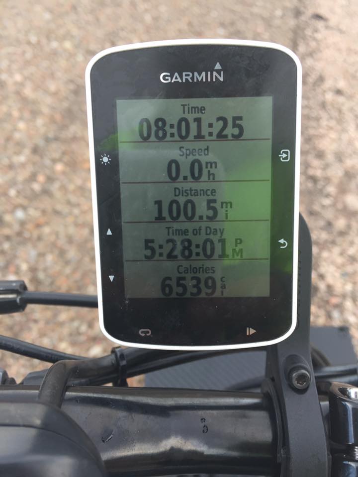
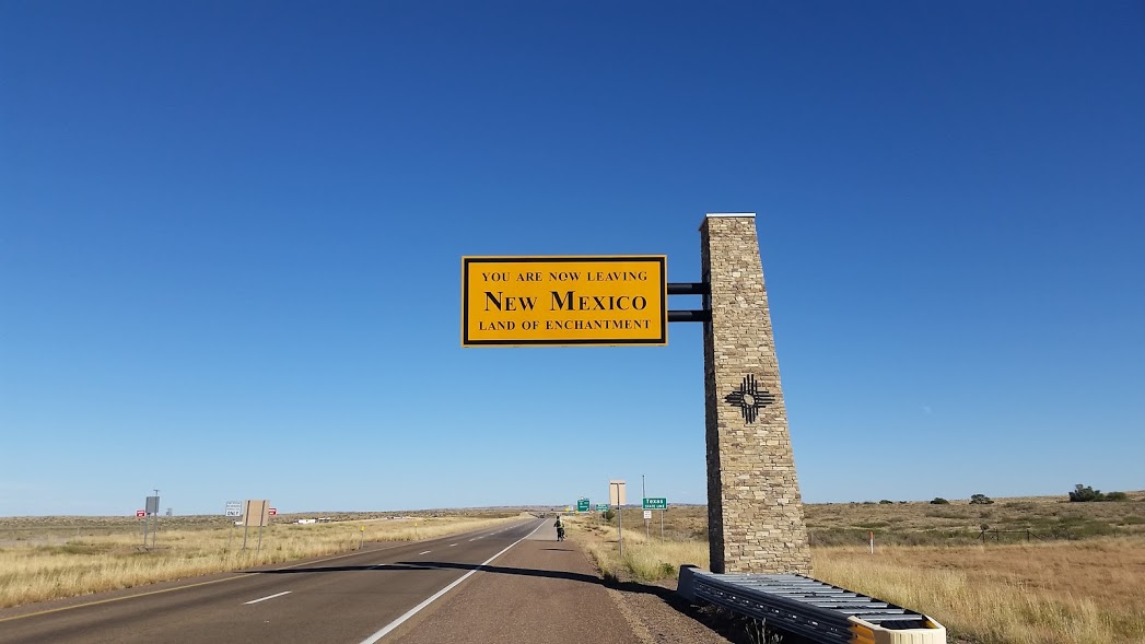
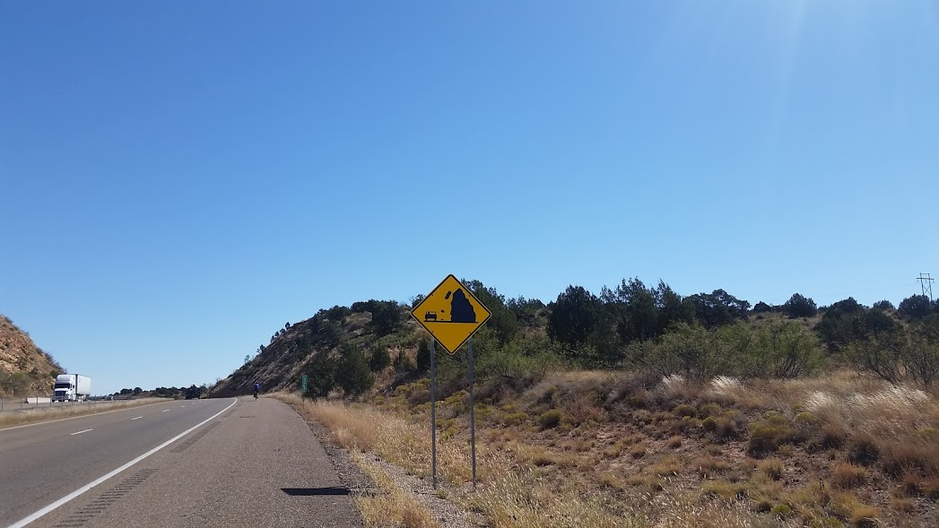
"text":"Rode about 100 miles today. Elevation 4540.
Today was a scheduled 'rest day' but instead we chose to bank some miles. With this century ride we are now exactly one day ahead of schedule. Staying in Santa Rosa, NM this evening. Tomorrow we will be heading into the Lone Star state.
",
"dlink":"http://maps.google.com/maps?daddr=Santa+Rosa%2C+NM%2C+United+States&t=m&layer=1&doflg=ptk&om=0",
"openpopup":"0",
"mapwidth":"640",
"mapwidthunit":"px",
"mapheight":"480",
"marker-createdby":"editor",
"marker-createdon":"2016-10-10 11:56:01",
"marker-updatedby":"editor",
"marker-updatedon":"2016-10-10 15:47:48",
"layerid":["17"],
"layername":"Day 11 - 19",
"layer-createdby":"editor",
"layer-createdon":"2016-10-10 11:55:03",
"layer-updatedby":"editor",
"layer-updatedon":"2016-10-18 11:43:12",
"controlbox":"0",
"overlays_custom":"0",
"overlays_custom2":"0",
"overlays_custom3":"0",
"overlays_custom4":"0",
"wms":"0",
"wms2":"0",
"wms3":"0",
"wms4":"0",
"wms5":"0",
"wms6":"0",
"wms7":"0",
"wms8":"0",
"wms9":"0",
"wms10":"0",
"kml_timestamp":"",
"gpx_url":"",
"gpx_panel":"0",
"mlm_filter":"1",
"mlm_filter_details":""
}},
{
"type":"Feature",
"geometry":
{
"type":"Point",
"coordinates":[-102.428261,35.242832]
},
"properties":
{
"markerid":"59",
"layers":["17"],
"requested_layer":["17"],
"markername":"Day 12 - October 10",
"basemap":"osm_mapnik",
"lat":"35.242832",
"lon":"-102.428261",
"icon":"hotel_0star.png",
"zoom":"11",
"iconUrl":"http://www.nickelplatetrail.org/wp-content/uploads/leaflet-maps-marker-icons/hotel_0star.png",
"address":"Vega, TX, United States",
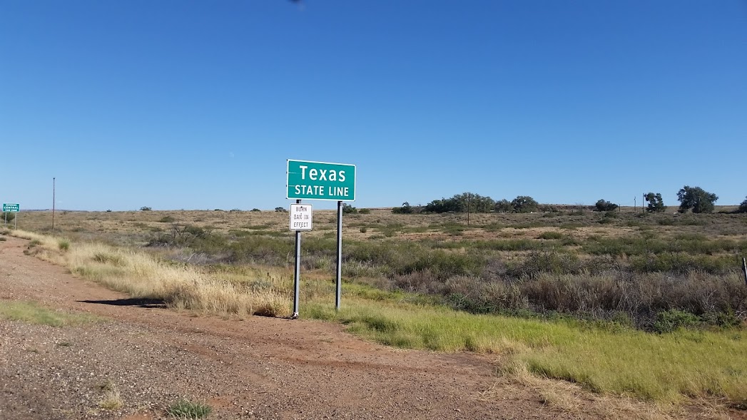
"text":"Rode 119 miles today. Elevation 3960. Good day today. We had a nice tailwind.
Made it to Texas!! Another state down.
",
"dlink":"http://maps.google.com/maps?daddr=Vega%2C+TX%2C+United+States&t=m&layer=1&doflg=ptk&om=0",
"openpopup":"0",
"mapwidth":"640",
"mapwidthunit":"px",
"mapheight":"480",
"marker-createdby":"editor",
"marker-createdon":"2016-10-10 20:56:54",
"marker-updatedby":"editor",
"marker-updatedon":"2016-10-10 20:56:54",
"layerid":["17"],
"layername":"Day 11 - 19",
"layer-createdby":"editor",
"layer-createdon":"2016-10-10 11:55:03",
"layer-updatedby":"editor",
"layer-updatedon":"2016-10-18 11:43:12",
"controlbox":"0",
"overlays_custom":"0",
"overlays_custom2":"0",
"overlays_custom3":"0",
"overlays_custom4":"0",
"wms":"0",
"wms2":"0",
"wms3":"0",
"wms4":"0",
"wms5":"0",
"wms6":"0",
"wms7":"0",
"wms8":"0",
"wms9":"0",
"wms10":"0",
"kml_timestamp":"",
"gpx_url":"",
"gpx_panel":"0",
"mlm_filter":"1",
"mlm_filter_details":""
}},
{
"type":"Feature",
"geometry":
{
"type":"Point",
"coordinates":[-100.246811,35.230477]
},
"properties":
{
"markerid":"60",
"layers":["17"],
"requested_layer":["17"],
"markername":"Day 13 - October 11",
"basemap":"osm_mapnik",
"lat":"35.230477",
"lon":"-100.246811",
"icon":"hotel_0star.png",
"zoom":"13",
"iconUrl":"http://www.nickelplatetrail.org/wp-content/uploads/leaflet-maps-marker-icons/hotel_0star.png",
"address":"Shamrock, TX, United States",
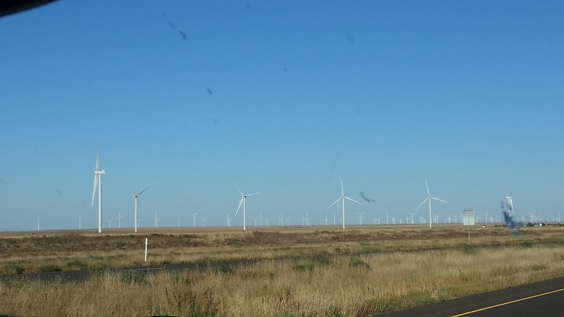
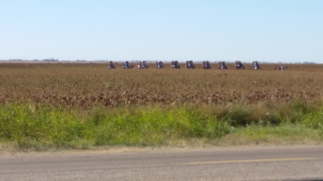
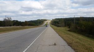
"text":"Rode 130 miles today. Elevation 2300. Nice tail wind again.
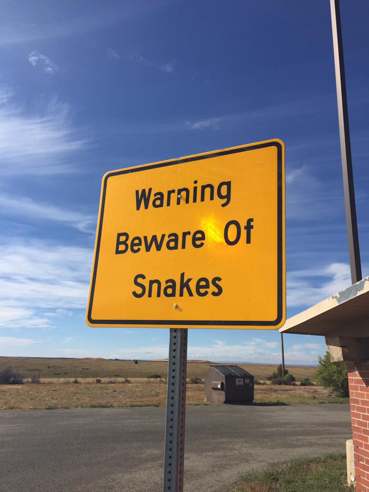
Around home a 200 acre field is pretty big. Out here I can't even see the entire field. They have to be 2000-3000 acres easily. It's amazing.
Almost missed this as we rode by. It was cool to actually see it
",
"dlink":"http://maps.google.com/maps?daddr=Shamrock%2C+TX%2C+United+States&t=m&layer=1&doflg=ptk&om=0",
"openpopup":"0",
"mapwidth":"640",
"mapwidthunit":"px",
"mapheight":"480",
"marker-createdby":"editor",
"marker-createdon":"2016-10-11 21:34:32",
"marker-updatedby":"editor",
"marker-updatedon":"2016-10-12 19:01:34",
"layerid":["17"],
"layername":"Day 11 - 19",
"layer-createdby":"editor",
"layer-createdon":"2016-10-10 11:55:03",
"layer-updatedby":"editor",
"layer-updatedon":"2016-10-18 11:43:12",
"controlbox":"0",
"overlays_custom":"0",
"overlays_custom2":"0",
"overlays_custom3":"0",
"overlays_custom4":"0",
"wms":"0",
"wms2":"0",
"wms3":"0",
"wms4":"0",
"wms5":"0",
"wms6":"0",
"wms7":"0",
"wms8":"0",
"wms9":"0",
"wms10":"0",
"kml_timestamp":"",
"gpx_url":"",
"gpx_panel":"0",
"mlm_filter":"1",
"mlm_filter_details":""
}},
{
"type":"Feature",
"geometry":
{
"type":"Point",
"coordinates":[-98.971024,35.509592]
},
"properties":
{
"markerid":"66",
"layers":["17"],
"requested_layer":["17"],
"markername":"Day 14 - October 12",
"basemap":"osm_mapnik",
"lat":"35.509592",
"lon":"-98.971024",
"icon":"hotel_0star.png",
"zoom":"12",
"iconUrl":"http://www.nickelplatetrail.org/wp-content/uploads/leaflet-maps-marker-icons/hotel_0star.png",
"address":"Clinton, OK, United States",
"text":"Rode 83 miles today. Elevation 1420.
",
"dlink":"http://maps.google.com/maps?daddr=Clinton%2C+OK%2C+United+States&t=m&layer=1&doflg=ptk&om=0",
"openpopup":"0",
"mapwidth":"640",
"mapwidthunit":"px",
"mapheight":"480",
"marker-createdby":"editor",
"marker-createdon":"2016-10-12 19:01:41",
"marker-updatedby":"editor",
"marker-updatedon":"2016-10-13 20:39:32",
"layerid":["17"],
"layername":"Day 11 - 19",
"layer-createdby":"editor",
"layer-createdon":"2016-10-10 11:55:03",
"layer-updatedby":"editor",
"layer-updatedon":"2016-10-18 11:43:12",
"controlbox":"0",
"overlays_custom":"0",
"overlays_custom2":"0",
"overlays_custom3":"0",
"overlays_custom4":"0",
"wms":"0",
"wms2":"0",
"wms3":"0",
"wms4":"0",
"wms5":"0",
"wms6":"0",
"wms7":"0",
"wms8":"0",
"wms9":"0",
"wms10":"0",
"kml_timestamp":"",
"gpx_url":"",
"gpx_panel":"0",
"mlm_filter":"1",
"mlm_filter_details":""
}},
{
"type":"Feature",
"geometry":
{
"type":"Point",
"coordinates":[-97.762544,35.506721]
},
"properties":
{
"markerid":"67",
"layers":["17"],
"requested_layer":["17"],
"markername":"Day 15 - October 13",
"basemap":"osm_mapnik",
"lat":"35.506721",
"lon":"-97.762544",
"icon":"hotel_0star.png",
"zoom":"11",
"iconUrl":"http://www.nickelplatetrail.org/wp-content/uploads/leaflet-maps-marker-icons/hotel_0star.png",
"address":"Yukon, OK, United States",
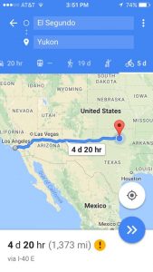
"text":"Rode 75 miles today. Elevation 1240.
1373 miles in the books so far! Tomorrow we will start our Northeast climb toward Kokomo. 9 days and 925 miles and we will be there. Today we were met with another cold/rainy day but it is done.
No pictures or videos today. It started out cold and windy and ended cold and rainy. We only got 75 miles today. Tough days like this are good, they test and build character. They help you truly appreciate the blue sky and sunny days on the bike. Anything worth doing is going to be challenging, it can be running a 5k, losing 10 pounds, getting an A in a hard class, lots of things, anything. It's not going to do itself for you, you have to get up, get moving, and get after 'it', whatever 'it' may be. Don't take it from me though, go find out for yourself. Set a goal, get after it
",
"dlink":"http://maps.google.com/maps?daddr=Yukon%2C+OK%2C+United+States&t=m&layer=1&doflg=ptk&om=0",
"openpopup":"0",
"mapwidth":"640",
"mapwidthunit":"px",
"mapheight":"480",
"marker-createdby":"editor",
"marker-createdon":"2016-10-13 20:23:52",
"marker-updatedby":"editor",
"marker-updatedon":"2016-10-14 20:43:15",
"layerid":["17"],
"layername":"Day 11 - 19",
"layer-createdby":"editor",
"layer-createdon":"2016-10-10 11:55:03",
"layer-updatedby":"editor",
"layer-updatedon":"2016-10-18 11:43:12",
"controlbox":"0",
"overlays_custom":"0",
"overlays_custom2":"0",
"overlays_custom3":"0",
"overlays_custom4":"0",
"wms":"0",
"wms2":"0",
"wms3":"0",
"wms4":"0",
"wms5":"0",
"wms6":"0",
"wms7":"0",
"wms8":"0",
"wms9":"0",
"wms10":"0",
"kml_timestamp":"",
"gpx_url":"",
"gpx_panel":"0",
"mlm_filter":"1",
"mlm_filter_details":""
}},
{
"type":"Feature",
"geometry":
{
"type":"Point",
"coordinates":[-97.058368,36.115607]
},
"properties":
{
"markerid":"68",
"layers":["17"],
"requested_layer":["17"],
"markername":"Day 16 - October 14",
"basemap":"osm_mapnik",
"lat":"36.115607",
"lon":"-97.058368",
"icon":"hotel_0star.png",
"zoom":"11",
"iconUrl":"http://www.nickelplatetrail.org/wp-content/uploads/leaflet-maps-marker-icons/hotel_0star.png",
"address":"Stillwater, OK, United States",
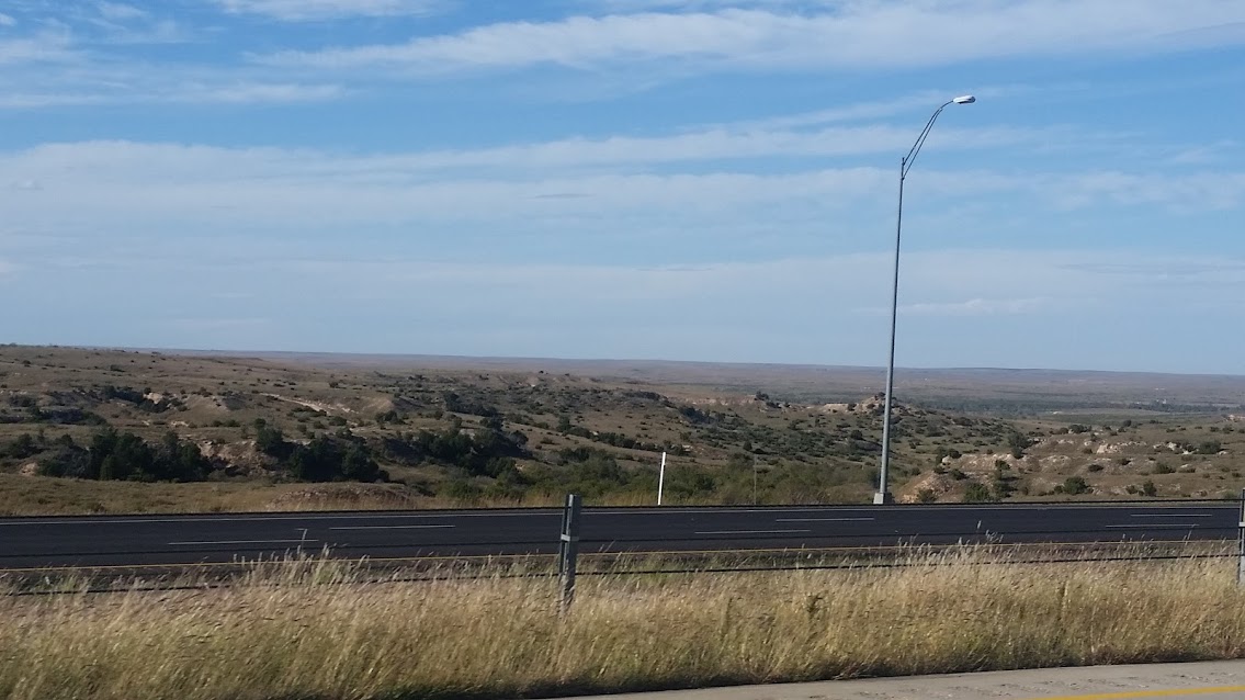
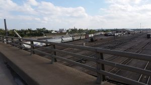
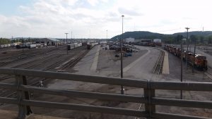
"text":"It's nice to be off the interstate and be on some slower paced roads, much more enjoyable. We saw some other cyclists and a few runners out there too.
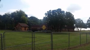
Cool caboose yard art. I want one in my front yard
",
"dlink":"http://maps.google.com/maps?daddr=Stillwater%2C+OK%2C+United+States&t=m&layer=1&doflg=ptk&om=0",
"openpopup":"0",
"mapwidth":"640",
"mapwidthunit":"px",
"mapheight":"480",
"marker-createdby":"editor",
"marker-createdon":"2016-10-14 20:31:00",
"marker-updatedby":"editor",
"marker-updatedon":"2016-10-16 17:40:25",
"layerid":["17"],
"layername":"Day 11 - 19",
"layer-createdby":"editor",
"layer-createdon":"2016-10-10 11:55:03",
"layer-updatedby":"editor",
"layer-updatedon":"2016-10-18 11:43:12",
"controlbox":"0",
"overlays_custom":"0",
"overlays_custom2":"0",
"overlays_custom3":"0",
"overlays_custom4":"0",
"wms":"0",
"wms2":"0",
"wms3":"0",
"wms4":"0",
"wms5":"0",
"wms6":"0",
"wms7":"0",
"wms8":"0",
"wms9":"0",
"wms10":"0",
"kml_timestamp":"",
"gpx_url":"",
"gpx_panel":"0",
"mlm_filter":"1",
"mlm_filter_details":""
}},
{
"type":"Feature",
"geometry":
{
"type":"Point",
"coordinates":[-95.617104,36.309246]
},
"properties":
{
"markerid":"69",
"layers":["17"],
"requested_layer":["17"],
"markername":"Day 17 - October 15",
"basemap":"osm_mapnik",
"lat":"36.309246",
"lon":"-95.617104",
"icon":"hotel_0star.png",
"zoom":"15",
"iconUrl":"http://www.nickelplatetrail.org/wp-content/uploads/leaflet-maps-marker-icons/hotel_0star.png",
"address":"Claremore, OK, United States",
"text":"Got 103.5 miles in today. Elevation 720.
Good weather, no big mechanical issues, overall a great day. Staying in Claremore OK.
Cruised by Tulsa today.

",
"dlink":"http://maps.google.com/maps?daddr=Claremore%2C+OK%2C+United+States&t=m&layer=1&doflg=ptk&om=0",
"openpopup":"0",
"mapwidth":"640",
"mapwidthunit":"px",
"mapheight":"480",
"marker-createdby":"editor",
"marker-createdon":"2016-10-16 17:34:18",
"marker-updatedby":"editor",
"marker-updatedon":"2016-10-16 17:34:19",
"layerid":["17"],
"layername":"Day 11 - 19",
"layer-createdby":"editor",
"layer-createdon":"2016-10-10 11:55:03",
"layer-updatedby":"editor",
"layer-updatedon":"2016-10-18 11:43:12",
"controlbox":"0",
"overlays_custom":"0",
"overlays_custom2":"0",
"overlays_custom3":"0",
"overlays_custom4":"0",
"wms":"0",
"wms2":"0",
"wms3":"0",
"wms4":"0",
"wms5":"0",
"wms6":"0",
"wms7":"0",
"wms8":"0",
"wms9":"0",
"wms10":"0",
"kml_timestamp":"",
"gpx_url":"",
"gpx_panel":"0",
"mlm_filter":"1",
"mlm_filter_details":""
}},
{
"type":"Feature",
"geometry":
{
"type":"Point",
"coordinates":[-94.513281,37.084227]
},
"properties":
{
"markerid":"70",
"layers":["17"],
"requested_layer":["17"],
"markername":"Day 18 - October 16",
"basemap":"osm_mapnik",
"lat":"37.084227",
"lon":"-94.513281",
"icon":"hotel_0star.png",
"zoom":"11",
"iconUrl":"http://www.nickelplatetrail.org/wp-content/uploads/leaflet-maps-marker-icons/hotel_0star.png",
"address":"Joplin, Missouri, United States",
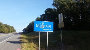
"text":"Rode 90 miles. Elevation 1240.
Another state down! Boom baby! Only made it 90 miles today, but it was a good day. We're trying to get 100+ in per day but sometimes it's just not in the cards.
",
"dlink":"http://maps.google.com/maps?daddr=Joplin%2C+Missouri%2C+United+States&t=m&layer=1&doflg=ptk&om=0",
"openpopup":"0",
"mapwidth":"640",
"mapwidthunit":"px",
"mapheight":"480",
"marker-createdby":"editor",
"marker-createdon":"2016-10-16 21:16:13",
"marker-updatedby":"editor",
"marker-updatedon":"2016-10-16 21:16:13",
"layerid":["17"],
"layername":"Day 11 - 19",
"layer-createdby":"editor",
"layer-createdon":"2016-10-10 11:55:03",
"layer-updatedby":"editor",
"layer-updatedon":"2016-10-18 11:43:12",
"controlbox":"0",
"overlays_custom":"0",
"overlays_custom2":"0",
"overlays_custom3":"0",
"overlays_custom4":"0",
"wms":"0",
"wms2":"0",
"wms3":"0",
"wms4":"0",
"wms5":"0",
"wms6":"0",
"wms7":"0",
"wms8":"0",
"wms9":"0",
"wms10":"0",
"kml_timestamp":"",
"gpx_url":"",
"gpx_panel":"0",
"mlm_filter":"1",
"mlm_filter_details":""
}},
{
"type":"Feature",
"geometry":
{
"type":"Point",
"coordinates":[-93.778269,38.368632]
},
"properties":
{
"markerid":"71",
"layers":["17"],
"requested_layer":["17"],
"markername":"Day 19 - October 17",
"basemap":"osm_mapnik",
"lat":"38.368632",
"lon":"-93.778269",
"icon":"hotel_0star.png",
"zoom":"11",
"iconUrl":"http://www.nickelplatetrail.org/wp-content/uploads/leaflet-maps-marker-icons/hotel_0star.png",
"address":"Clinton, MO, United States",
"text":"Long day Rode 130 miles. Lots of rolling hills, nice strong winds out of the south helped push to the north.
",
"dlink":"http://maps.google.com/maps?daddr=Clinton%2C+MO%2C+United+States&t=m&layer=1&doflg=ptk&om=0",
"openpopup":"0",
"mapwidth":"640",
"mapwidthunit":"px",
"mapheight":"480",
"marker-createdby":"editor",
"marker-createdon":"2016-10-18 10:54:30",
"marker-updatedby":"editor",
"marker-updatedon":"2016-10-18 11:37:38",
"layerid":["17"],
"layername":"Day 11 - 19",
"layer-createdby":"editor",
"layer-createdon":"2016-10-10 11:55:03",
"layer-updatedby":"editor",
"layer-updatedon":"2016-10-18 11:43:12",
"controlbox":"0",
"overlays_custom":"0",
"overlays_custom2":"0",
"overlays_custom3":"0",
"overlays_custom4":"0",
"wms":"0",
"wms2":"0",
"wms3":"0",
"wms4":"0",
"wms5":"0",
"wms6":"0",
"wms7":"0",
"wms8":"0",
"wms9":"0",
"wms10":"0",
"kml_timestamp":"",
"gpx_url":"",
"gpx_panel":"0",
"mlm_filter":"1",
"mlm_filter_details":""
}}]});